|
|
| 43번째 줄: |
43번째 줄: |
| | #display_map: | | #display_map: |
| | Seoul City; | | Seoul City; |
| − | 37.57260006348283 | + | 37.57260006348283, 127.0136300818751 |
| | |service=googlemaps3 | | |service=googlemaps3 |
| | |width=300 | | |width=300 |
| 58번째 줄: |
58번째 줄: |
| | #display_map: | | #display_map: |
| | Seoul City; | | Seoul City; |
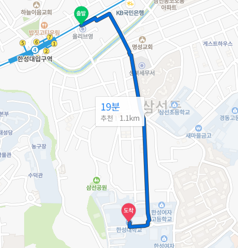
| − | 127.0136300818751 | + | 37.58135071423302, 127.01267528674725 |
| | |service=googlemaps3 | | |service=googlemaps3 |
| | |width=300 | | |width=300 |
삼선교.한성대학교.조소앙활동터
성북02
지도를 불러오는 중...
{"minzoom":false,"maxzoom":false,"mappingservice":"googlemaps3","type":"ROADMAP","types":["ROADMAP","SATELLITE","HYBRID","TERRAIN"],"width":"300px","height":"300px","centre":false,"title":"","label":"","icon":"http://maps.google.com/mapfile\ns/marker.png","visitedicon":"","lines":[],"polygons":[],"circles":[],"rectangles":[],"wmsoverlay":false,"copycoords":false,"static":false,"zoom":12,"layers":[],"controls":["pan","zoom","type","scale","streetview"],"zoomstyle":"DEFAULT","typestyle":"DEFAULT","autoinfowindows":false,"resizable":false,"kmlrezoom":false,"poi":true,"markercluster":false,"clustergridsize":60,"clustermaxzoom":20,"clusterzoomonclick":true,"clusteraveragecenter":true,"clusterminsize":2,"tilt":0,"imageoverlays":[],"kml":[],"gkml":[],"fusiontables":[],"searchmarkers":"","enablefullscreen":false,"locations":[{"text":"\u003Cb\u003E\u003Cdiv class=\"mw-parser-output\"\u003E\u003C/div\u003E\u003C/b\u003E\u003Chr /\u003E\u003Cdiv class=\"mw-parser-output\"\u003E\u003C/div\u003E","title":"","link":"","lat":37.589752503533,"lon":127.00936119297,"icon":"http://maps.google.com/mapfile\ns/marker.png"}]}
지도를 불러오는 중...
{"minzoom":false,"maxzoom":false,"mappingservice":"googlemaps3","type":"ROADMAP","types":["ROADMAP","SATELLITE","HYBRID","TERRAIN"],"width":"300px","height":"300px","centre":false,"title":"","label":"","icon":"http://maps.google.com/mapfile\ns/marker.png","visitedicon":"","lines":[],"polygons":[],"circles":[],"rectangles":[],"wmsoverlay":false,"copycoords":false,"static":false,"zoom":12,"layers":[],"controls":["pan","zoom","type","scale","streetview"],"zoomstyle":"DEFAULT","typestyle":"DEFAULT","autoinfowindows":false,"resizable":false,"kmlrezoom":false,"poi":true,"markercluster":false,"clustergridsize":60,"clustermaxzoom":20,"clusterzoomonclick":true,"clusteraveragecenter":true,"clusterminsize":2,"tilt":0,"imageoverlays":[],"kml":[],"gkml":[],"fusiontables":[],"searchmarkers":"","enablefullscreen":false,"locations":[{"text":"\u003Cb\u003E\u003Cdiv class=\"mw-parser-output\"\u003E\u003C/div\u003E\u003C/b\u003E\u003Chr /\u003E\u003Cdiv class=\"mw-parser-output\"\u003E\u003C/div\u003E","title":"","link":"","lat":37.58248751038,"lon":127.01132564139,"icon":"http://maps.google.com/mapfile\ns/marker.png"}]}
도보
동대문역.흥인지문
종로03
지도를 불러오는 중...
{"minzoom":false,"maxzoom":false,"mappingservice":"googlemaps3","type":"ROADMAP","types":["ROADMAP","SATELLITE","HYBRID","TERRAIN"],"width":"300px","height":"300px","centre":false,"title":"","label":"","icon":"http://maps.google.com/mapfile\ns/marker.png","visitedicon":"","lines":[],"polygons":[],"circles":[],"rectangles":[],"wmsoverlay":false,"copycoords":false,"static":false,"zoom":12,"layers":[],"controls":["pan","zoom","type","scale","streetview"],"zoomstyle":"DEFAULT","typestyle":"DEFAULT","autoinfowindows":false,"resizable":false,"kmlrezoom":false,"poi":true,"markercluster":false,"clustergridsize":60,"clustermaxzoom":20,"clusterzoomonclick":true,"clusteraveragecenter":true,"clusterminsize":2,"tilt":0,"imageoverlays":[],"kml":[],"gkml":[],"fusiontables":[],"searchmarkers":"","enablefullscreen":false,"locations":[{"text":"\u003Cb\u003E\u003Cdiv class=\"mw-parser-output\"\u003E\u003C/div\u003E\u003C/b\u003E\u003Chr /\u003E\u003Cdiv class=\"mw-parser-output\"\u003E\u003C/div\u003E","title":"","link":"","lat":37.572600063483,"lon":127.01363008188,"icon":"http://maps.google.com/mapfile\ns/marker.png"}]}
지도를 불러오는 중...
{"minzoom":false,"maxzoom":false,"mappingservice":"googlemaps3","type":"ROADMAP","types":["ROADMAP","SATELLITE","HYBRID","TERRAIN"],"width":"300px","height":"300px","centre":false,"title":"","label":"","icon":"http://maps.google.com/mapfile\ns/marker.png","visitedicon":"","lines":[],"polygons":[],"circles":[],"rectangles":[],"wmsoverlay":false,"copycoords":false,"static":false,"zoom":12,"layers":[],"controls":["pan","zoom","type","scale","streetview"],"zoomstyle":"DEFAULT","typestyle":"DEFAULT","autoinfowindows":false,"resizable":false,"kmlrezoom":false,"poi":true,"markercluster":false,"clustergridsize":60,"clustermaxzoom":20,"clusterzoomonclick":true,"clusteraveragecenter":true,"clusterminsize":2,"tilt":0,"imageoverlays":[],"kml":[],"gkml":[],"fusiontables":[],"searchmarkers":"","enablefullscreen":false,"locations":[{"text":"\u003Cb\u003E\u003Cdiv class=\"mw-parser-output\"\u003E\u003C/div\u003E\u003C/b\u003E\u003Chr /\u003E\u003Cdiv class=\"mw-parser-output\"\u003E\u003C/div\u003E","title":"","link":"","lat":37.581350714233,"lon":127.01267528675,"icon":"http://maps.google.com/mapfile\ns/marker.png"}]}
